Old Coach Road & Five Bridge Lakes: Into the Wild
A 55 km gravel loop from Timberlea, Nova Scotia, through Five Bridge Lakes Wilderness Area on Old Coach Road. Punchy climbs, rocky descents. Had a blast. My first 'real' gravel ride!
Its my first 'real ride' I would rate it higher but there isnt really an 'easy' way to get to the entrance...I went down the on ramp near the sobeys at the 103.
Conditions on the day
September 12, 2026Route was in great shape, some puddles as around 3 days before we had a pretty decent storm...nothing I couldn't ride through though.
Why this ride
I had no clue what to expect going into this one. I'd just had a bike fit a couple of days before with Adrian Wong (physiotherapist and bike fitter out of Dartmouth, highly recommend) and had new wheels and tires on, so I really wanted to get out. It turned into my first "real" gravel ride: a 55 km loop from Timberlea, through Five Bridge Lakes Wilderness Area on Old Coach Road, and back along the head of St. Margarets Bay.
Km by km
- km 0–2TimberleaSide streets out of the neighbourhood: Charles Road, Fraser Road, Forestglen Drive, Frasers Mill Walk.
- km 2–6St. Margarets Bay Road to the 103Straight into a climb of about 50 m, with a 7% kick near km 4. Then down the on-ramp by the Sobeys and alongside the 103 to Greenhead Road. There's no easy way into this trail, and this is the least bad one I found.
- km 6–12Greenhead RoadPast Otter Lake and the Western Common, with a 20 m climb around km 8–9.5, then a quick 30 km/h run down to Old Coach Road.
- km 12.6Old Coach RoadThis is where it gets wild. You drop about 50 m on the steepest descents of the day, over 8% near km 12.5 and 13.4, with rocks and some washout.
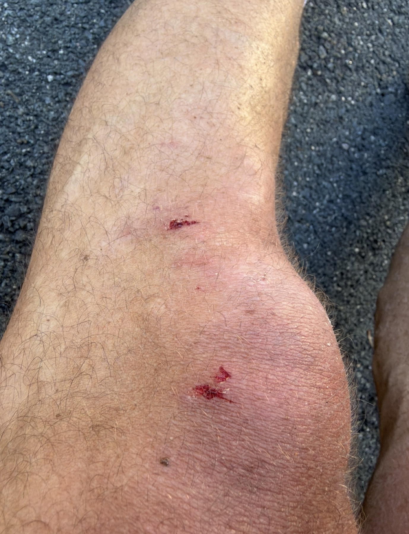
- km 14–16The big climbThe hardest climb of the ride: about 55 m with a 9% pitch near km 15. This is where my front wheel spun out and I went down.
- km 16–21Five Bridge Lakes Wilderness AreaStill on Old Coach Road, and the slowest stretch of the day (about 15 km/h average), with a short 7% kick near km 19.
- km 21–28.6Ralph Wheadon TrailNorth through the lakes. Still rough, but faster.
- km 28.6–35Big Hubley Lake Drive and Old Halifax RoadOut of the woods and onto quiet roads, mostly downhill. The transition is smooth, and you get time to adjust and hydrate before you have to deal with cars.
- km 35–42Peggys Cove Road through Glen Haven and TantallonDown almost to sea level at the head of St. Margarets Bay, then the big road climb back up to Upper Tantallon: about 75 m, with a 7% pitch near km 41.
- km 42–55St. Margarets Bay Road homePast Lewis Lake and Five Island Lake. Top speed of the day (44 km/h) comes dropping back toward Timberlea around km 53, then a short kick up to the finish.
Surface & tire call
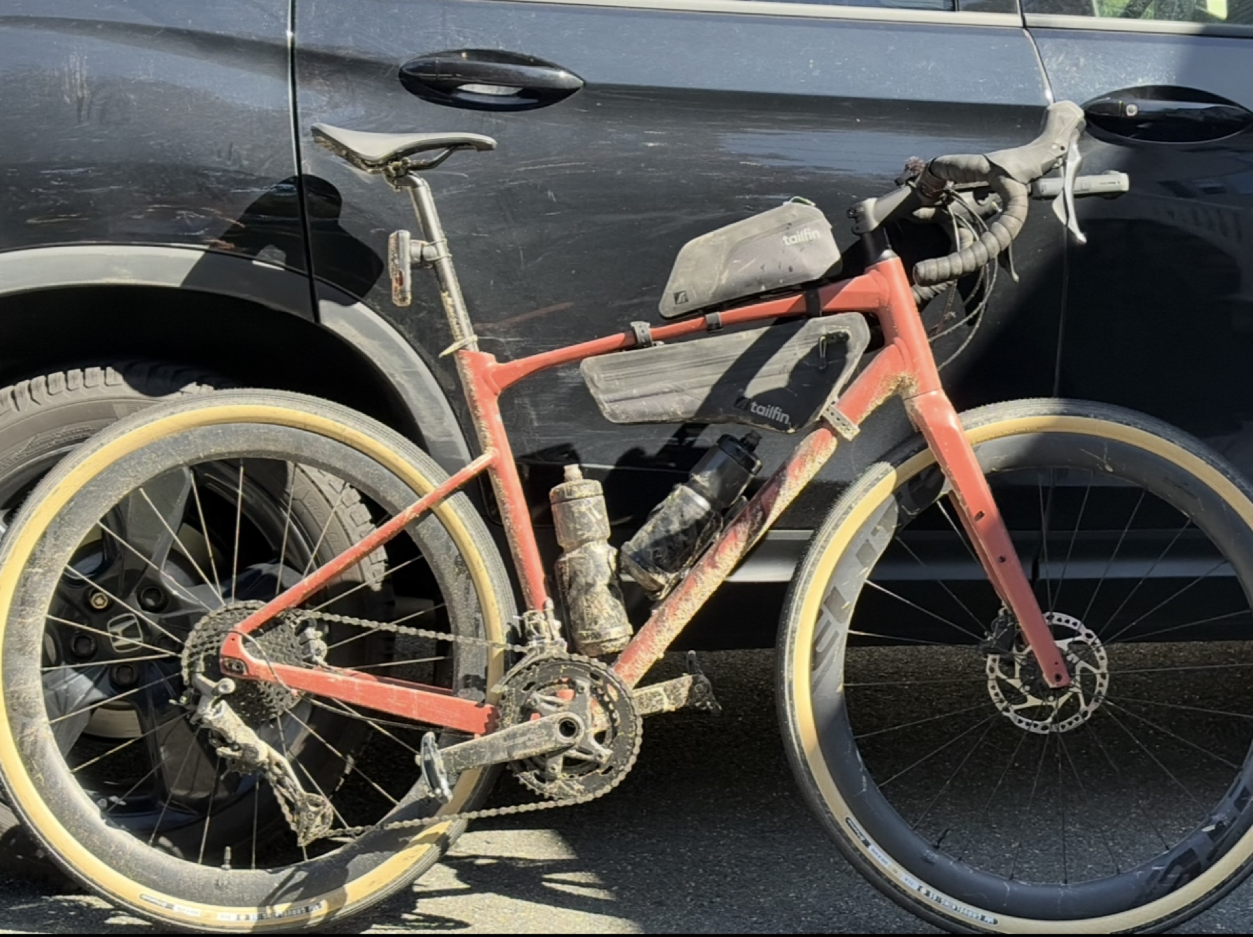
I ran 45 mm GravelKing SS R tires on Elitewheels (gravel aero +). On the 32 mm inner rim they blow out to about 50.5 mm. On a 25 mm rim they'd probably be closer to the stated 45.
I wouldn't do this ride again on these tires. Unless you're going quite slow, it gets sketchy in places, and I wiped out going up a steep hill when my front wheel spun out. Lessons learned.
Watch out for
- Getting in. You go down the on-ramp and alongside the 103 to reach Greenhead Road. There is plenty of room on the shoulder/gravel, it's very little travel to do once the on ramp ends.
- The rocky descents around km 12.5–13.5, and the loose climb right after at km 14–16.
- Cars once you reach Peggys Cove Road and St. Margarets Bay Road.
Depending on when you go there might be hunting happening (wear orange), the trail is also wide enough for ATVs so you may have a few (they won't be travelling fast). You are far enough out that I would make sure to bring a repair kit for any tire punctures/mechanicals as it would be quite annoying to have to walk out from there. Travel with another rider if you can.
Options
After Peggys Cove Road you can take St. Margarets Bay Road back, or hop on the rail trail instead (less climbing, no cars). I took St. Margarets Bay Road and got yelled at by some teenager. Go figure.
Next time
Can't wait to do this one again on some real gravel tires.
Photos